
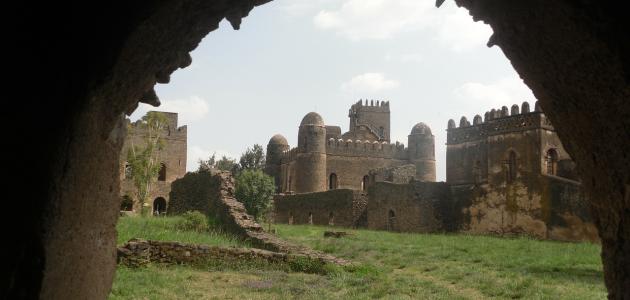
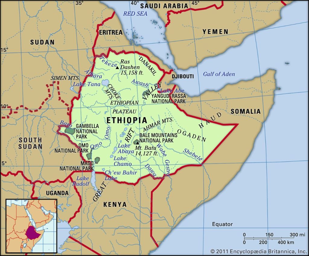
Ethiopia as it was called Abyssinia in the past, is a landlocked country located in the Horn of Africa, and its capital is Addis Ababa. It is bordered to the east by Djibouti and Somalia, to the north by Eritrea, to the northwest by Sudan, to the west by South Sudan, and to the southwest by Kenya. Ethiopia has a total area of 1 100 000 square kilometers and is home to more than 109 million people, Ethiopia on map.
Ethiopia on map, the state of Ethiopia is a landlocked country, meaning that it does not overlook any sea or gulf. It is located specifically in the middle of the eastern side of the Horn of Africa, on the borders of six other countries: Eritrea, Djibouti, Somalia, Kenya, South Sudan, and Sudan.
It is bordered to the north and northeast by Eritrea, to the east by Djibouti and Somalia, to the south by Kenya, to the northwest by Sudan, and to the southwest by South Sudan.
Ethiopia covers an area of 1,104,300 square kilometers or 426,372.61 square miles. This makes it larger than Mauritania but smaller than South Africa. Ethiopia and Sudan are connected from western Ethiopia by a common land border. The two countries have a close relationship dating back to ancient times, as one of the main trade routes for Ethiopia extended westward to Sudan and then to Egypt, and Muslim merchants in Sudan were an important part of Ethiopia’s trade for centuries. Despite this, relations between the two countries were not always friendly, as a military conflict began between the two countries in the 1850s.
The capital of Ethiopia is Addis Ababa, and it is also the capital of the African Union and the Oromia region of Ethiopia. Addis Ababa is located in the middle of Ethiopia, at an altitude of 2,500 meters above sea level, with an area of about half a square kilometer.
In Ethiopia, there is an upper central plateau with an elevation of 1290-3000 m above sea level, and its highest mountain peak reaches 4533 m. Many rivers pass through it, the most famous of which is the Blue Nile River, which originates from Lake Tana. The plateau descends gradually from the Sudanese lowlands in the west and the Somali plains in the southeast.
Central Ethiopia is the region of a wide plateau known as the Abyssinian Plateau, which covers more than half of the country’s area. The plateau is divided from northeast to southwest by the Great African Rift. Although the height of the plateau is about 1,675 meters or 5,694 feet, it is crossed by many rivers and deep valleys, and some of these rivers and valleys reach about 610 meters or 2,001 feet below the level of the plateau. The area is covered with mountains, the highest of which is Ras Dashen Mountain, with a height of 4,620 meters, or 15,158 feet.
Leave a Reply